
Walking a Roswell Street by Address
A Roswell street directory works from the address outward. The Chaves County property account identifies a parcel and owner of record. The county map supplies parcel context. The Clerk’s recorded-document index can extend the ownership trail. A dated reverse directory, if the selected volume has one, can add historical published address evidence. These sources do not make a complete list of everyone on a street. Their strength is the way an account, legal description, and recorded instrument can be checked against one another.
Keep the street direction, designation, unit, and date with each result. Roswell addresses may be read through a city name, a county parcel system, and a delivery ZIP, and those labels do not always answer the same geographic question. The current street-directory route should begin with the actual street address rather than a broad person-name query.
- Enter the address in Chaves County EagleWeb. Compare the full situs address, account number, parcel number, and legal description before selecting a result.
- Open the same location in the Chaves County GIS Web Map. Pan along the segment to see parcel breaks, adjacent lots, roads, and other map context.
- For voter information, use only the official channel that fits the request. NMVOTE is a personal registration service, not an open street-browse list; any broader data route is governed by the Secretary of State’s authorization process and Safe at Home protections.
- Use the parcel’s legal description to search the owner in the Chaves County document index. Confirm the description before connecting a grantee or grantor to the address.
- For a historic question, check a dated Roswell city-directory volume and use a reverse or criss-cross section only when that exact edition contains one.
Note: A street-by-street search is strongest when every conclusion is limited to the date and type of record actually found.
Roswell Street Directory in EagleWeb
EagleWeb is the County’s address-keyed tool for current ownership, tax history, and assessment history. Its structured situs search is especially useful when a street name has directions, a unit, or a common designation. The county says to place an asterisk after a street name for a whole-street return, for example Main*. That wider result still needs account-by-account review because an account describes property context and owner of record, not a household roster.
The public form includes basic and advanced options. Use the smallest combination that identifies the right parcel, then preserve the search form fields with the result. The CityZip control narrows an address query. It is not a boundary decision or a ZIP-wide people search.
| Address field | How it narrows a Roswell street | Published form note |
|---|---|---|
| House Number and Extent | Locates a particular address range | Optional structured situs fields |
| Direction Suffix / Direction | Separates directional street variants | Blank, E, N, S, SE, or W options |
| Street Name | Searches the named street | Append * for a whole-street search |
| Designation and Unit | Distinguishes street type and a specific unit | Designations include AVE, BLVD, DR, LN, RD, ST, and WAY |
| CityZip | Further narrows an address/property search | Not a city-limits test |
| Subdivision, lot, block, tract | Connects a street result to a legal description | Available through advanced search |
Open the Chaves County EagleWeb property search before beginning a Roswell street directory inquiry.
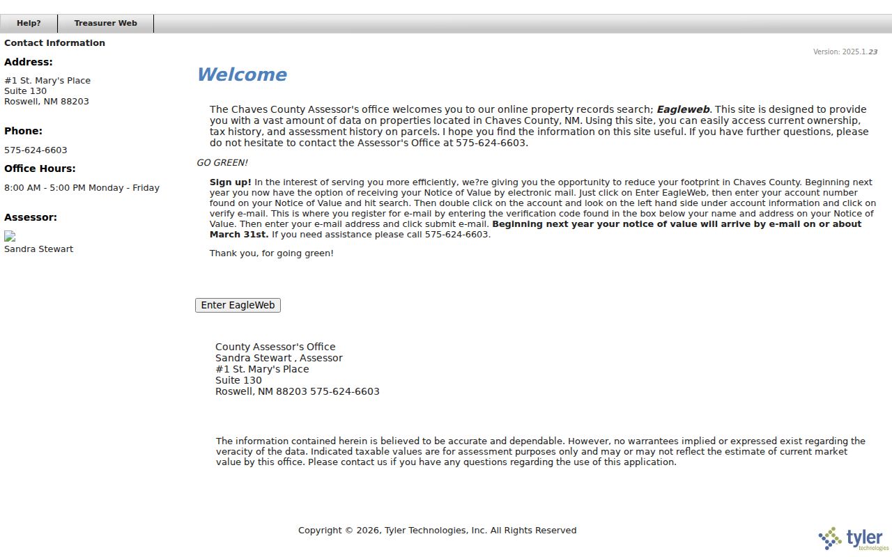
Its separate address, owner, account, parcel, and legal-description fields make it possible to verify which search path produced a street result.
Roswell Street Parcels on the Map
The County’s free GIS Web Map is the map-first companion to EagleWeb. County documentation describes an interactive map with property information, surface-ownership and flood-zone layers, plus export and print functions. It covers more than 35,000 parcel records across nearly four million acres, so a Roswell street can sit beside large county parcels or service corridors that need map context.
Use the map to inspect parcel outlines and nearby lots, then return to EagleWeb for account, owner, and legal details. The live application’s exact current layer labels and popup order were not verified in the research, so do not assume a visible map layer proves every ownership or tax field. A polygon next to the focal parcel is a mapped property relationship, not a claim about a neighboring household.
Roswell Street Directory Record Coverage
Address-keyed sources vary in what they can confirm. A property account is a current administrative relationship. The GIS map shows parcel geography. A recorded document establishes a dated transaction or filing link. A permit can tie an owner or project to a project address at a point in time. Historical directory evidence is tied to its printed edition. Reading each result in its own category prevents a street directory from turning partial records into a claim about every person along the block.
| Address-keyed source | What it can show | Roswell access | Important limit |
|---|---|---|---|
| EagleWeb property account | Owner of record, parcel, situs, assessment and tax context | Free public account search | Owner of record is not a full occupancy statement |
| GIS parcel map | Parcel outlines, nearby lots, and map layers | Free county map | Map context needs account verification |
| Recorded documents | Grantor, grantee, legal description, date, and instrument reference | Tyler Web, workstations, or Clerk request | Street address is often translated through land description |
| City permit or code file | Address, owner information, lot/block, and project information | NextRequest or Community Development | No public individual-record search portal located |
| Historic directory | Published address entry for a selected year | Library collection and physical research route | Volume-specific and not a current result |
The usual chain is address to property account, property account to legal description, legal description to the recorded instrument, then a separate dated directory or city file when the question needs an era. Keep both the parcel path and the instrument path because the Clerk’s search instructions distinguish Book/Page and Instrument Number methods.
Roswell Street Deed Chain
Chaves County Clerk’s Tyler Web instructions provide a local key for a deed search. Enter an Either Name as last name, a blank, then first name, without punctuation. From EagleWeb, record the current owner, parcel or account, situs, and legal description. Search the owner as a likely grantee, then compare the document’s legal description with the property before recording the prior grantor and reference.
The published format rules matter. The Clerk lists Book/Page for July 1, 1987 through November 27, 2019, and Instrument Number for December 2, 2019 forward. Certain later document types can continue with Book/Page. These are search-method dates, not a statement that earlier records do not exist. For an earlier period, use the Clerk’s public workstations or ask which books, film, or record route covers the needed date.
Public document images can be purchased through Tyler Web for $0.50 per page. If a document contains protected information, the Clerk describes a staff-verification process for an unredacted request. A document connects recorded parties to an instrument, not every individual who may have been at the street address.
Note: Match the legal description and date before treating a seller or grantee as part of one Roswell street history.
Roswell Street Address Language
A street directory search can fail when a familiar address is not translated into the land-record terms used by the County. Preserve directions, street type, unit, and CityZip from the address result. Then keep the legal description with the parcel and document search. These fields answer different questions but create a reliable bridge when they refer to the same property.
- Parcel
- A mapped county property account, usually tied to an account or parcel number.
- Situs address
- The property’s location, distinct from an address used for tax correspondence.
- Plat
- A recorded map that can show a subdivision’s lots, blocks, and layout.
- Legal description
- The formal land locator, such as subdivision, lot, block, tract, or survey fields.
- Criss-cross directory
- A historical address-organized section, when included in a particular directory volume.
Roswell’s historical city boundaries also changed. The City was formally created in 1903 and expanded through annexations, including a major airport-area annexation in 1968. An old deed or directory may therefore need a date-specific county and municipal reading rather than a modern label added after the fact.
Roswell Address Files at City Hall
For a specific city-held file, use the City of Roswell IPRA process and the NextRequest portal. The City’s building-permit application shows the kinds of address fields a permit file may contain: project address, owner information, lot, block, subdivision, project type, and work description. No official public search interface for individual permits or code cases was located.
A focused request should state the address, defined record type, and date period. Community Development is the relevant department for permit and code material, and the City directs requests through its records process. Scheduled inspection is free; the City posts a prepaid minimum for digital copies and separate fees for paper and other materials. A permit helps date a property or project. It does not provide a present street roster.
Historic Roswell Street Directory Evidence
Older Roswell street research should be date-first. The Public Library’s digitized city-directory project includes the completed 1947 and 1971 through 1996 runs, while established collection listings also identify earlier 1912 through 1936 volumes. Inspect the chosen volume rather than assuming it contains every year or a reverse section. Roswell Daily Record microfilm begins in 1903 and can provide notices or address-era context that should be cross-checked against the directory and deed trail.
The 1905 Roswell Sanborn map is a seven-sheet snapshot of blocks and buildings. It can help orient an historic street reference, but it does not identify current residents or settle a modern parcel boundary. No official Roswell-wide street-renumbering chronology or complete historic-address crosswalk was located in the research. Ask the Library, County GIS, City Planning, or an archive a narrow street-and-date question instead of guessing an old address conversion.
Roswell Street ZIP and Boundary Checks
ZIP labels should be checked at the address level. Roswell’s confirmed delivery ZIP context includes 88201 and 88203, while 88202 appears on official Roswell post-office-box mailing addresses. The Census result identifies 88201 and 88203 as ZCTAs, which are statistical approximations rather than delivery boundaries. A street directory should not use a mailing ZIP as proof of municipal status or parcel location.
Use the USPS address lookup with the full address, direction, and unit for delivery verification. Then compare the result with County GIS and the parcel account when the question concerns jurisdiction or property. EagleWeb’s CityZip field is a useful narrowing control, but it does not create a ZIP-wide resident list.
Roswell Street Directory Privacy Limits
A street directory cannot disclose every person connected to an address. Assessor and deed records can lag a move and do not list all non-owner occupants or household members. NMVOTE is not an open by-street directory. Court Case Lookup removes addresses and personally identifying information. Motor-vehicle address information is protected, and utility or delivery customer data is not a public street roll.
Safe at Home shields participant residential, delivery, telephone, and email information, subject to the program’s rules and court-order limits. An absent address may be intentional. Public-record access does not authorize a user to fill gaps through inference, surveillance, or repeated contact.
Lawful use. Use Roswell street records for personal, historical, property, estate, or civic research and respect limits set by each custodian. Do not use an address record to stalk, harass, intimidate, or harm anyone.
The most reliable correction path is the original custodian: the Assessor for a property account, the Clerk for a recorded-document issue, the court clerk for a docket question, and the Secretary of State or County Clerk for voter matters. Keep the source and date checked so the office can identify the record under discussion.